


+3
شاهد ذكرياتك


المغرب اليوم - Morocco Today
٢٤ يونيو ٢٠١٦ ·
نهر يانغستي الجميل بالصين وكأنه من نسج الخيال ! سبحان الخالق
تمت مشاركة ذكرى بواسطة Fareed Zaffour.
***********************
اليانغتسى - Yangtze
نهر "يانغ تسه" (بالـصينية: Listen,扬子江 ) أطول أنهار الـصين -وآسيا- وثالث أطول أنهار العالم بعد نهر النيل في إفريقيا ونهر الأمازون في أمريكا الجنوبية. يبلغ طوله 6380 كم.
ينبع النهر من جبل ثلجي في جبال تانغ غولا في التبت (على ارتفاع 6600 م) بمقاطعة كوينجهاي، ويصل ارتفاع هذه الجبال إلى حوالي 4,880م فوق مستوى سطح البحر. ويتدفق النهر شرقًا، ونحو الجنوب الشرقي، ثم إلى الجنوب نحو مقاطعة يونَّان، ومنها يتدفق نحو الشمال الشرقي عبر مقاطعة سشوان. ثم يتدفق في شكل مجرى غير منتظم نحو الشرق، وخلال وسط الصين، ثم يدخل إلى بحر شرق الصين على مسافة 6,300كم من منبعه. ويصرف نهر يانجتسي وفروعه المياه من مساحة تقرب من 1,829,000 كم².
وتتسبّب الجبال العالية في منبع يانجتسي، في التدفق السريع للنهر في معظم مجراه. وتجعله المضايق الكبيرة في أجزائه العليا، فوق يتسهانج، واحدًا من أكثر الأنهار جمالاً في العالم. وربما تقع أكبر محطات توليد الكهرباء من القوة المائية في العالم فوق يتسهانج. وتُشكِّل الجبال التي يصل ارتفاعها إلى أكثر من 1,6 كم، شواطئ النهر. وتنتشر أكثر من نصف تجارة المحيط في الصين فوق نهر يانجتسي وفروعه. وتصل السفن البخارية التي تمخر عباب المحيط إلى ووهان بوساطة النهر بطول 1,090كم، من الشاطئ. أما الزّوارق الصغيرة فيمكنها الإبحار إلى مسافة 1,600كم، وهو أبعد مكان في الداخل.
ويعيش الآلاف من الصينيين عند نهر يانجتسي على مهنة الإبحار بقوارب تسمى الينك. كما يعيش الملايين من الصينيين على ضفاف هذا النهر. وتتسبب فيضانات الصيف العرضية والمؤقتة في إجلاء كثير من السكان خارج منازلهم. ومن بين المدن الكبيرة على طول نهر يانجتسي شانغهاي، ونانجينغ، ونانكينغ، ويتسهانج، وشونجينج، و ووهان .
نهر اليانغتسي شريان رئيسي للمواصلات النهرية، يربط بين شرق وغرب البلاد، ويسمى "المجرى المائي الذهبي". يتفرع عنه حوالي 700 من الروافد. تتواجد أخصب الأراضي في البلاد على مناطق مجرى نهر اليانغتسي الأوسط والأسفل.
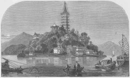
الجزيرة الذهبية، on The Yang-Tse River, China (LMS, 1869, p.64)[6]
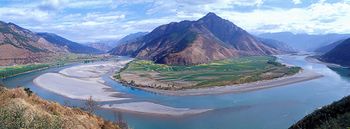
الإلتفاف الأول لنهر يانغ تسي عند شيغو (石鼓), مقاطعة يونـّان, حيث يلتف النهر 180 درجة من الإتجاه جنوباً إلى الإتجاه شمالاً.
 |
هذه المقالة تحتوي على نصوص بالصينية. بدون دعم الإظهار المناسب, فقد ترى علامات استفهام ومربعات أو رموز أخرى بدلاً من الحروف الصينية. |
الأسماء
 "Yangtze River (Cháng jiāng)" in Simplified (top) and Traditional (bottom) Chinese characters |
|
| 长江 | |
| 長江 | |
| "The Long River" | |
| |
|
| 扬子江 | |
| 揚子江 | |
| |
|
| འབྲི་ཆུ་ | |
| |
|
الجغرافيا
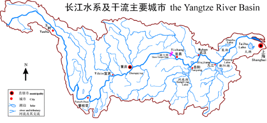
حوض اليانغ تسى
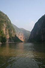
الابحار عبر المضائق الثلاثة على نهر يانغ تسه
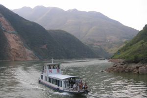
Cruise on the Yangtze River before sunset
The river originates from several tributaries in the eastern part of the Tibetan Plateau, two of which are commonly referred to as the "source." Traditionally, the Chinese government has recognized the source as the Tuotuo tributary at the base of a glacier lying on the west of Geladandong Mountain in the Tanggula Mountains. This source is found at 33°25′44″N 91°10′57″E and while not the furthest source of the Yangtze, it is the highest source at 5,342 م (17,526 قدم) above sea level. The true source of the Yangtze, hydrologically the longest river distance from the sea, is at Jari Hill at the head of the Dam Qu tributary, approximately 325 kم (202 ميل) southeast of Geladandong.[7] This source was only discovered in the late 20th century and lies in wetlands at 32°36′14″N 94°30′44″E and 5,170 م (16,960 قدم) above sea level just southeast of Chadan Township in Zadoi County, Yushu Prefecture, Qinghai.[8] As the historical spiritual source of the Yangtze, the Geladandong source is still commonly referred to as the source of the Yangtze since the discovery of the Jari Hill source.[7]
These tributaries join and the river then runs eastward through Qinghai (Tsinghai), turning southward down a deep valley at the border of Sichuan (Szechwan) and Tibet to reach Yunnan. In the course of this valley, the river's elevation drops from above 5,000 m (16,000 ft) to less than 1,000 m (3,300 ft). The headwaters of the Yangtze are situated at an elevation of about 4,900 m (16,100 ft). In its descent to sea level, the river falls to an altitude of 305 m (1,001 ft) at Yibin, Sichuan, the head of navigation for riverboats, and to 192 m (630 ft) at Chongqing (Chungking). Between Chongqing and Yichang (I-ch'ang), at an altitude of 40 m (130 ft) and a distance of about 320 km (1,050,000 ft), it passes through the spectacular Yangtze Gorges, which are noted for their natural beauty but are dangerous to shipping.
It enters the basin of Sichuan at Yibin. While in the Sichuan basin, it receives several mighty tributaries, increasing its water volume significantly. It then cuts through Mount Wushan bordering Chongqing and Hubei to create the famous Three Gorges. Eastward of the Three Gorges, Yichang is the first city on the Yangtze Plain.
After entering Hubei, the Yangtze receives water from a number of lakes. The largest of these lakes is Dongting Lake, which is located on the border of Hunan and Hubei provinces, and is the outlet for most of the rivers in Hunan. At Wuhan, it receives its biggest tributary, the Han River, bringing water from its northern basin as far as Shaanxi.
At the northern tip of Jiangxi, Lake Poyang, the biggest freshwater lake in China, merges into the river. The river then runs through Anhui and Jiangsu, receiving more water from innumerable smaller lakes and rivers, and finally reaches the East China Sea at Shanghai.
Four of China's five main freshwater lakes contribute their waters to the Yangtze River. Traditionally, the upstream part of the Yangtze River refers to the section from Yibin to Yichang; the middle part refers to the section from Yichang to Hukou County, where Lake Poyang meets the river; the downstream part is from Hukou to Shanghai.
The origin of the Yangtze River has been dated by some geologists to about 45 million years ago in the Eocene,[9] but this dating has been disputed.[ممن؟].[10][11]
معرض صور

The glaciers of the Tanggula Mountains, the traditional source of the Yangtze River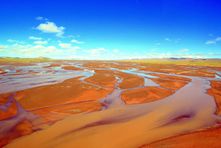
The Tuotuo River, a headwater stream of the Yangtze River, known in Tibetan as Maqu, or the "Red River"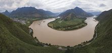
The first turn of the Yangtze at Shigu (石鼓) in Yunnan, where the river turns 180 degrees from south- to north-bound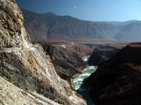
The Jinsha River in Yunnan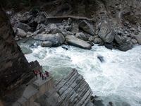
The Tiger Leaping Gorge near Lijiang downstream from Shigu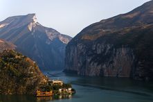
Qutang Gorge, one of the Three Gorges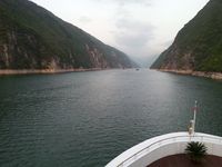
Wu Gorge, one of the Three Gorges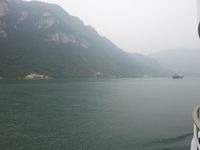
Xiling Gorge, one of the Three Gorges
